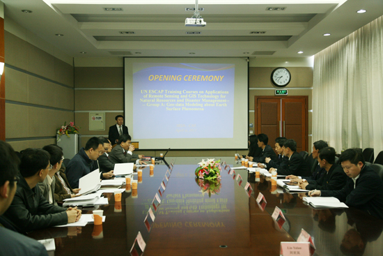
UN ESCAP training program on “Applications of Remote Sensing and GIS Technology for Natural Resources & Disaster Management: Geo-data Modeling about Earth Surface Phenomena” was launched in Beijing, China, on April 11, 2011. Training program is jointly sponsored by United Nations Economic and Social Council for Asia Pacific (UN ESCAP), and Institute of Remote Sensing Applications (IRSA) under Chinese Academy of Sciences (CAS), and co-organized by Chinese National Committee for Remote Sensing (CNCRS), The Associate on Environment Remote Sensing of China (AERSC), and Committee of Environmental Information System and Remote Sensing, Chinese Society for Environmental Sciences (CEIR-CSES).
Training courses are divided into Group A, B, C, among which Group A is organized by IRSA, and was kicked off by an opening ceremony on April 11, with the presence of officials from CNCRS, UN ESCAP, United Nations Platform for Space-based Information for Disaster Management and Emergency Response (UN SPIDER) and IRSA, together with lecturer representatives.
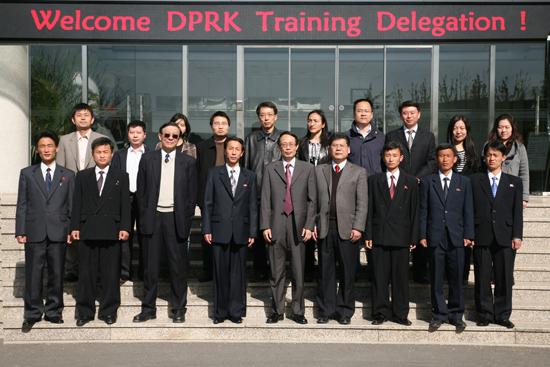
Training class consists of 18 participants from Democratic People’s Republic of Korea (DPRK), all professionals in remote sensing related areas of DPRK, and lecturers’ team, unquestionably top experts within remote sensing field from China’s research institutes, universities and governmental agencies.
Group A is scheduled for 49 days, followed by Group B, C courses, and the whole courses are supposed to be finished at the end of July. Group A, B, C as a whole is designed to provide systemic training for 18 DRRK participants with regard to geo-data modeling about Earth surface phenomena, GIS development, software and applications, satellite images processing theory and related knowledge. Training Courses will adopt various forms including lectures, computer simulation practices, and visits to China’s governmental agencies like National Geomatic Center of China and National Committee for Disaster Reduction, and research institutes including Chinese Academy of Forestry Sciences, China Institute of Water Resources and Hydropower Research, and Chinese Academy of Agricultural Sciences, all involving remote sensing applications
Training program aims to help DPRK train qualified professionals in remote sensing and GIS areas, and thereby to promote its ability in natural resources and disaster management, for the benefits of DPRK’s economy and society.