|

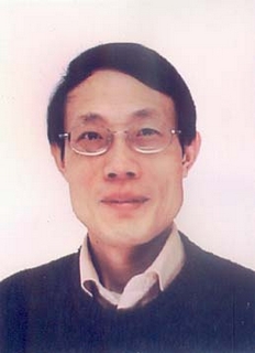
Xingfa GU
Male
Research Professor
2007 - present Director , Institute of Remote Sensing Applications, CAS
2005 - 2007 Executive Director, Institute of Remote Sensing Applications, CAS
2004 - present Director of Demonstration Center for Spaceborne Remote Sensing, National Space Administration, CNSA, China
2003- present Professor, Institute of Remote Sensing Applications, Chinese Academy of Science
1993-2003 Researcher, National Institute for Agricultural Research (INRA), French
1991-1993 Postdoctoral Researcher, National Institute for Agricultural Research (INRA), French
1987-1991 Master Degree, Ph.D in Physical Remote Sensing, 7th University of Paris
1982 Bachelor of Engineering, Wuhan Technical University of Surveying and Mapping, China
Accomplishments and Contributions
Gu Xingfa has dedicated to research on the quantitative RS and the radiometric calibration for a long period and has published many research papers.
1. In 1990, as a key member in a research group, Gu Xingfa and his group established the second radiometric calibration site-LA CRAU in France, which only came after the Whitesand calibration site in USA. He put forwarded some theories about the selection of calibration, requirements of the atmosphere and the environment, criterion of measurement, etc. At the same time, he pointed out the errors existing in the calibration for TM led by the SLATER of ARIZONA University and improved the calibration method for the TM and SPOT. The results were adopted by the Space Center in France, which established the basis for the application of SPOT.
2. He founded the visible, near infrared and thermal aircraft RS System for Institute National de la Recherche Agronomique(INRA, Fr).
3. He put forward the some new approaches of MTF assessment and compensation.
4. He developed the measuring method of the thermal spectrum and its orientation; and developed the core model to describe the thermal directions and the radiometric transfer model for component temperature of row crops.
5. Gu Xingfa has led his research team to make many innovative achievements. The TITICACA Lake and the UYUNI site in Bolivia were selected during the field work by international scientist’s team organized by Gu Xingfa. These two sites were later used by the MODIS thermal experts. He chaired the ‘Chinese-France Quantitative RS Workshop’ in 2000 and the ‘First International Thermal RS Workshop’ in 2001. With his efforts, the integrated field works had been performed at Dunhuang calibration site and at LA CRAU site, which enhanced the construction and application of China RS ground system. After he returned back from France, he has helped to construct the Huailai experiment site, which had promoted the quantitative RS application in China.
6. Early in 1991, he had performed the cross calibration for NOAA, Landsat and SPOT.
7. Gu Xingfa helped to establish the Dun Huang calibration site in our country. And he was the first one who led an international research group to perform radiometric calibration works in Dun Huang site.
8. Gu Xingfa is now working on demonstration of space remote sensing, calibration, validation, aerosol, emulation of remote sensing images, and new sensor development. He and his group have studied on calibration and their achievements have been published in two special issues.
Since 1990, Prof. Xingfa GU has already published over 100 journal articles, in which has 20 SCI papers, 32 EI papers. |

